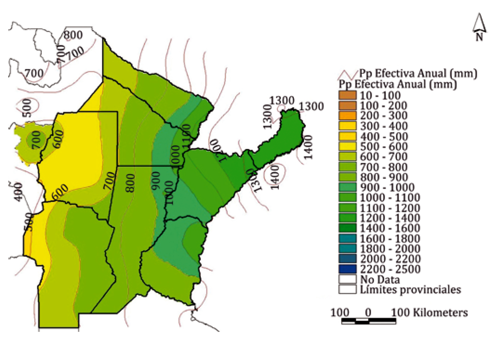
Spatial distribution of reference crop evapotranspiration and effective rainfall in the central-northeastern provinces of Argentina
Keywords:
irrigation requirements, crop water demand, water use planning, complementary/supplementary irrigation, productivityAbstract
This paper falls within the framework of the FAO-INA Agreement that was entered into to "identify new potential irrigated and supplementary-irrigated areas in the basins of northeastern Argentina". The agreement seeks to collect information on monthly reference crop evapotranspiration (ETo), analyze its variability, and show it on isoline maps. The study comprised the central northeastern part of Argentina; the program used was CROPWAT 8.0 – FAO; and climate data were obtained from CLIMWAT 2.0. The information was plotted with ArcView 3.2ª and the variables of interest were
interpolated with the Kriging method. Results show that: a) Santiago del Estero is the station with the highest annual ETo: 1767 mm.year-1, while the lowest ETo value is found in Loreto (Misiones) with 1150 mm.year-1; b) the average ETo in January ranges between 160 to 200 mm.month-1, while in July it is between 35 - 90 mm.month-1; c) the average ETo in January in the northeastern part of Cordoba ranges between 165 - 185 mm. month-1 while in July the variability is less pronounced; and d) rainfall in an average hydrological year ranges between 605 and 1825 mm.year-1 with an effective rainfall of 500 and 1400 mm.year-1 that tends to increase towards the northeast.
Downloads

Downloads
Published
How to Cite
Issue
Section
License
Aquellos autores/as que tengan publicaciones con esta revista, aceptan las Políticas Editoriales.


.jpg)


